
Energy Resilience in Queenstown
Keeping our lights on, our homes warm, and our town functioning in the face of disasters.

What would it look like locally?
How it would impact us in Queenstown, and how our infrastructre would cope (or not).
Learn more
How to improve energy resilience
You can start small, and know your options for how to have energy resilience.
Learn moreWhat are the risks?
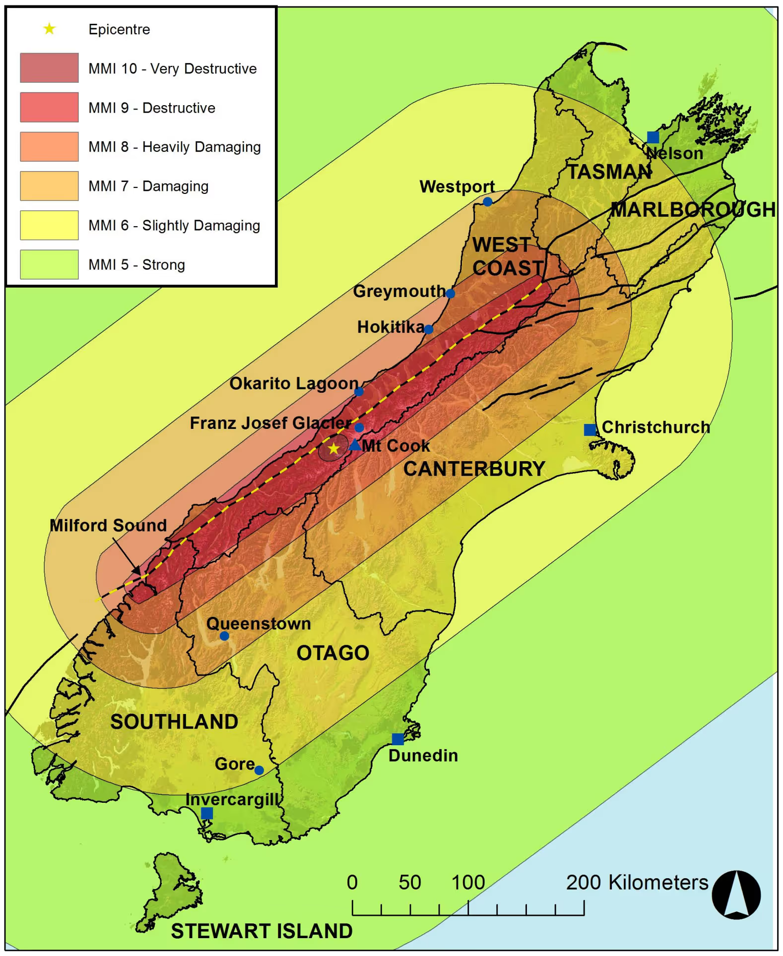
Queenstown faces multiple natural environment risks, like flooding and landslides, but the greatest risk is likely a large earthquake. The Alpine Fault line runs just north-west of Queenstown, and a significant earthquake along that fault line is both expected, and predicted to cause negative impacts on Queenstown.
This type of event is known as AF8, or Alpine Fault Magnitude 8 or above. It is important to note that earthquake magnitudes are based on a non-linear scale. A magnitude 8.0 earthquake is 10,000 times bigger than a magnitude 4.0 earthquake and has a 1,000,000 times stronger energy release.
The recent July 16 2026 earthquake in Milford Sound, felt by many in Queenstown, was a 5.9. An 8.5 would be about 400 times stronger than this and release about 7,000 times more energy. There is also a chance that it could be closer to Queenstown than this one was.
There is further information on the AF8 website here, and you can understand the difference in sizes of earthquakes here.
How likely is this? (very)
The Alpine Fault has been studied in great detail for many decades. It has ruptured an estimated 27 times in the last 8,000 years, on average once every 300 years. The last major earthquake was in 1717. This was 309 years ago in 2026 and we are therefore overdue.
Current scientific estimates predict a 75% chance that the Alpine Fault will rupture in the next 50 years, and an 82% chance of that rupture being a magnitude 8.0 or higher event. While it is impossible to predict the future, there is a high chance that this occurs within the lifetime of anyone reading this.
It’s important to note, that it can be easy to view a long term risk like this as being a distant event, but given the time since the last quake, there is still a shockingly high probability that this could happen within months or years.
More reading here.
What would it look like locally?
It is unlikely that the epicentre of the earthquake will be in Queenstown, which means we will hopefully not experience the full force of the earthquake. It is expected that most buildings will survive, however the force will likely be strong enough to significantly damage infrastructure through both initial shaking and landslides.
This means that while most people will hopefully be safe from physical risks in their homes, they are likely to be struck with the aftermath of significant infrastructure loss. This could mean no power, for possibly weeks or months, and no road access to the region. With no road access to evacuate or or receive supplies, and no power coming along power lines, Queenstown residents and tourists would be presented with a challenge unlike any in the region's history.
If this happened in winter like the recent 5.9 earthquake on July 16 2026, freezing and dark conditions would make the challenge even more difficult.
The photo below shows a real landslide just outside Glenorchy, to scale compared to the Queenstown CBD. A large-scale earthquake is expected to create hundreds or thousands of landslides, and as a region with steep mountainsides all around, these present significant risks.
How would our infrastructure handle this?
Less than 1% of the energy used in Queenstown is created locally. We are heavily reliant on a combination of electricity delivery via a single line (as shown in the picture), and fuel delivery via roads, which could easily be blocked by landslides in an earthquake.
Fuels
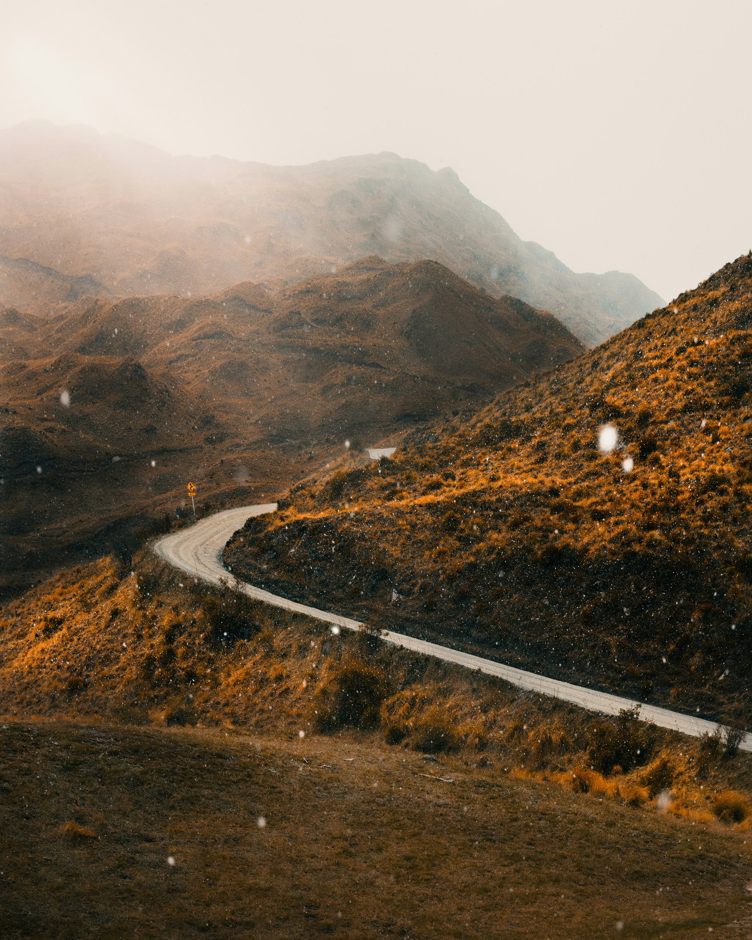
Our access roads Kawarau Gorge, Crown Range, and Kingston Highway, are how fuel (petrol, diesel, Gas/LPG) is delivered into Queenstown. Each of these roads is treacherous in its own way, and could relatively easily be blocked after a large earthquake event by landslides. All of these roads traverse along an edge cut into mountainous terrain. This is especially important to note when thinking about how long our generators may be able to run for. If, for example, a hospital or airport has two weeks of diesel stored, it may be hard to deliver further diesel at scale to keep these facilities and community buildings running if road access is blocked.
Electricity
Our electricity in the region comes almost entirely (minus a some solar installations and mini hydro dams) along one line into the region, that traverses the Kawarau Gorge. This line is highly susceptible to landslide and earthquake risk, and if it were to be knocked down could cut off power to the region, possibly for months. There are plans to build another line, along the same gorge, but those plans are unlikely to significantly benefit Queenstown’s resilience in a material way because it will face the same risks.
However, unlike with fuels, it is possible to make electricity within Queenstown, and many homes and some businesses are already doing this (see the map of solar installations below). As of mid-2026, there are around 1,000 different solar installations in Queenstown, many with batteries to provide backup power. Now that solar and battery economics stack up in a way that they can create net-savings from the investment, building energy resilience into a home can come at net financial benefit rather than as an aditional cost. Win-win opportunities like this are important especially in a place like Queenstown where resilience, while not often measured, can provide us with value as well.


What you can do to increase energy reslience
It’s important to note, there a lots of ways you should prepare for a disaster, such as:
- Reviewing your local Community Resilience Guide
- Knowing where to go locally, such as Community Emergency Hubs.
- Having acess to food, water and medical supplies.
- Preparing an emergency Grab Bag
Below we focus on different levels of energy resilience.
Level 1: Emergency preparedness ($100)Emergency first aid materials and a go bag to evacuate if needed
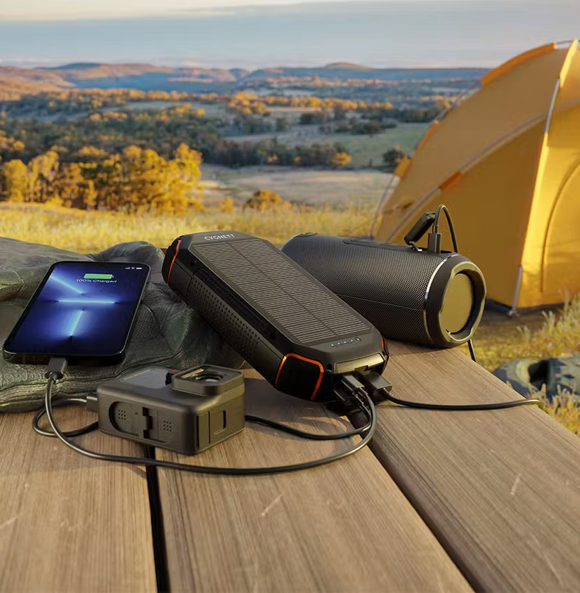
- Pack a basic solar powerbank in your Grab Bag to charge phones
While not enough power to help you heat your home or boil water, a basic solar power bank can be purchased for under $100 and will enable you to charge phones and other devices. While phone networks may be down, some phones now enable satellite communications as well. An emergency radio and a satellite locator beacon are also great to have on hand. Other benefits of this include being useful for adventures. Example: Harvey Norman Solar Power Bank
Level 2: Basic energy resilience ($500 - $3,000)
- Portable battery and portable solar panel (EcoFlow example)
The next level up in energy resilience is to have a small portable battery and solar panel, which could power larger items such as a small kettle to boil water, an internet router, and other items that normally require 230 Volt power point connection in a home. These portable solar and battery systems vary in price, and keep in mind not all will be powerful enough to run a kettle for example, but the bigger systems are also heavy, so there is a balance between portability and power to keep in mind.
This type of portable battery power station can also be used to help lower bills at home, for example it can be plugged into the fridge and scheduled via an app to charge up with cheap power overnight, and then use that power for the fridge at peak times or in the case of a blackout. This option is also possible for renters who can’t necessarily install their own solar and battery system. Example: Power Stations at Noel Leeming

Level 3: Sustainable energy resilience ($15,000 - $40,000)
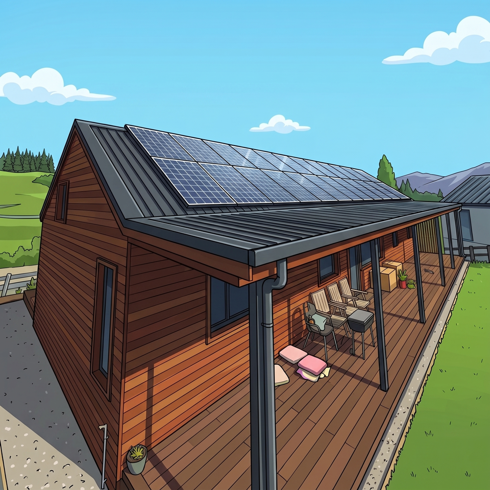
- Home solar and battery installation
A home solar and battery installation is where it’s possible to reach a level of sustained energy resilience, or in other words long term energy resilience in the face of a disaster. While it is true the sun does not always shine, over the stretch of any few days more often than not one or many of those days have sunlight that can run a solar panel.
The good news today is that over the lifetime of a solar and battery system, most households can make a net profit from the investment. So as long as they have access to financing through a mortgage, Green loan, the (hopefully forthcoming) Ratepayer Assistane Scheme, or they have the money available in savings, this type of resilience investment can save more than it costs over time while providing that resilience. Keep in mind a bigger battery will help provide more hours, or even days, of resilience.
Example: MySolarQuotesNZ
Level 4: Mobile energy resilience ($ depends on car choice)
- A vehicle with V2L functionality
A vehicle can be a great lifeline in the face of a disaster. Many electric vehicles sold today have vehicle-to-load functionality, or in other words, allow you to plug in a power point to the car and power any common home appliances. Some cars have a plug directly in the vehicle, others require a V2L adapter, which are readily available to be purchased and generally only a few hundred dollars.
The battery in an electric vehicle is often 3 to 4 times the average amount of electricity consumed by a home in one day, so it can be a great way to store extra electricity generated by solar, or to have multiple days of power available to you in an emergency even without solar.
As the vehicle is not part of the home, this type of energy resilience is also available to renters. See list of vehicles with V2L capability

